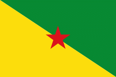
Sinnamary
Sinnamary is a town and commune on the coast of French Guiana, between Kourou and Iracoubo. Sinnamary was the second French settlement founded in French Guiana: the town was founded in 1664.
Sinnamary lies on the Sinnamary River and is home to the Guianan Soyuz launch site. In 1792, the first prison for priests and political enemies was constructed in Sinnamary. The town contains an Indonesian community, as well as a Galibi Amerindian community. Both communities produce artwork and jewellery that can be purchased. The main hotel in Sinnamary is the Hôtel du Fleuve.
The first colonists arrived in the area in 1624, however the town of Sinnamary was officially established in 1664. Sinnamary was taken twice by the Dutch, and once by the British, until in 1763, it was awarded to France by the Treaty of Paris. In 1764, about 40 families of Acadians, still living in exile after the Grand Dérangement nine years earlier, settled in Sinnamary. In 1792 during the French Revolution, the first prison for priests and political enemies opened in Sinnamary which was a precursor of the penal colony of French Guiana. After Napoleon reintroduced slavery in 1802, the town started to grow, and the discovery of gold caused a second boom.
The Guianan Soyuz launch site is situated within the territory of the Sinnamary commune. Colloquially the site and/or project are thus sometimes called "Soyuz at Sinnamary". However, because most other facilities of the Centre Spatial Guyanais are in the neighbouring and more populous Kourou commune, and because the entire CSG itself is thus often called the Kourou space centre, the Guianan Soyuz site/project is also occasionally called "Soyuz at Kourou", even though this is technically incorrect.
Map - Sinnamary
Map
Country - French_Guiana
 |
 |
French Guiana is the second-largest region of France (more than one-seventh the size of Metropolitan France) and the largest outermost region within the European Union. It has a very low population density, with only 3.6 PD/sqkm. (Its population is less than 1⁄200 that of Metropolitan France.) Half of its 301,099 inhabitants in 2023 lived in the metropolitan area of Cayenne, its capital. 98.9% of the land territory of French Guiana is covered by forests, a large part of which is primeval rainforest. The Guiana Amazonian Park, which is the largest national park in the European Union, covers 41% of French Guiana's territory.
Currency / Language
| ISO | Currency | Symbol | Significant figures |
|---|---|---|---|
| EUR | Euro | € | 2 |
| ISO | Language |
|---|---|
| FR | French language |


